
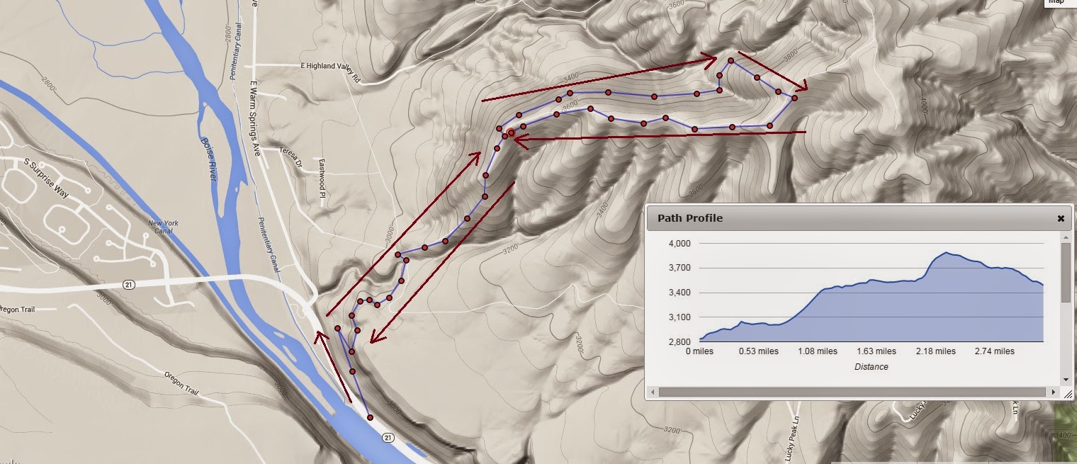
Today I made about a 4 1/2 mile loop up and back in the Boise foothills.
I don't know the name of this hill, but it is the hill where the hang glider folks launch from.
It is in east Boise, up near Hammer Flats.
Today I did some exploring up there. The road is very steep going up to the ridge, but the view is very rewarding. It was awesome. There is quite a view of the valley. The trees are just about peak color now.
It is easy to see, from the ridge, why the hill is popular for hang gliding. The ridge itself is about 10 feet wide, relatively flat with a trail, with both sides gradually sloping down to a precipitous drop off. The curvature is ideal for someone to make a running start with their hang glider, going downhill, and launching from the edge out over an expansive valley.
I continued on up the ridge, and took a side trail, which was really just a terrace contoured along the hill. It might have been an old fire break line. The single track was fairly well defined and easy to follow. I could trace the contour ahead for at least 2 or 3 miles around the steadily rising ridge.
When I got around on the back side of the ridge, it was SO quiet! It always amazes me how such vast distances can be so silent and peaceful. I took a beeline up the hill and connected to the road/path along the top of the ridge and followed it back to the hang glider launching section. From there I came back down the same path to the car, parked near Diversion Dam.
I would like to continue on up the ridge and make the connection to Highland Valley Road, and then continue on up to the summit of Lucky Peak.
The climb was a good test of my injured ankle. It did really well, with my neoprene compression sock.
see the attached map for my path today....
No comments:
Post a Comment